The History of Llandrinio
Llandrinio lies in the valley of the Severn, and on the B4393, 12km north-east of Welshpool.
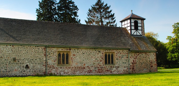
The church, which is the settlement core, is less than 400m from the river, but though the
valley floor is generally both broad and flat, there are minor fluctuations in height resulting
from alluvial or gravel deposits. It appears that Llandrinio occupies one such raised ‘platform’,
most obviously apparent on the approach from the west and north.
The main road passing through Llandrinio on an east/west axis was a turnpike road and
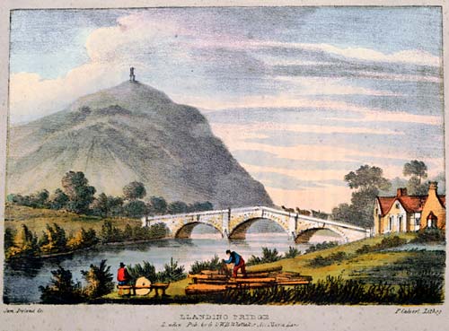
Llandrinio Bridge, dated to 1775, indicates that the road is not a modern development.
However, an earlier track undoubtedly existed and a charter of 1309 apparently refers to a
ferry (1249) that operated in the vicinity of the later bridge.


The church was established in the early medieval period, and almost certainly emerged as a
mother church for the area. There is circumstantial evidence for a community here,
including an unconfirmed tradition of it being a sanctuary or place of refuge, and the small
churchyard was once considerably larger, in keeping with such an important establishment. It
is interesting too that in 1526 it was recorded as a place of pilgrimage.
The name refers to the church of St Trinio and is first referenced as Llantrinew in the Norwich Taxation of 1254. Subsequent forms of the place-name vary so that in 1309 there is Llandrunion in Dendour and in 1385 Llandrunyo.
A charter of 1309 granted a weekly market and two annual fairs to the lord of Llandrinio, though what significance this carries regarding the settlement here is unclear. On present evidence it is impossible to determine whether there was ever a nucleated settlement at Llandrinio, and at the end of the 18th century the density of buildings was very much the same as it is today.
Low earthworks, particularly on the west side of the churchyard appear to indicate former enclosures (7571), some of which are depicted on the late 18th century map. A track and perhaps ridge and furrow have also been recognised (7572). The 1799 estate map referred to above, also shows open-field trips to the south-east of the churchyard and the north-east of New Hall, implying medieval cultivation.
Llandrinio Bridge, three-arched and with cutwaters, carries a datestone of 1775. Archdeacon Thomas claimed that in the medieval period there had been a ferry across the Severn at this point, as referred to in the charter of 1309.

